Emerging GIS Analyst | Spatial Data Visualization | 12+ Years Art Direction
Welcome, I’m Geoff Bock and I’m an emerging GIS Analyst with 12+ years of art direction experience, bringing Geographic Information Systems, spatial analysis, cartography, and design thinking to roles where complex data needs to become clear, actionable maps. Skilled in ArcGIS Pro, ArcGIS Online, Python, SQL, and spatial workflows, I build interactive web maps, automate geospatial processes, and translate technical findings for planning, environmental, and technical teams. From four-scenario infill capacity modeling for Prince William County, VA, to exploring NDVI analysis and urban greenspace stress in Portland, I help stakeholders make confident decisions with information that is understandable, visually compelling, and decision-ready.
the Work
Design across mediums, from motion and digital to branding and immersive environments, built to tell stories that resonate.
SELECTED PARTNERSHIPS
-
![]()
The Forescout Brand
A multi-year creative journey shaping Forescout’s presence worldwide, spanning website redesigns, collateral, motion, and social to define a stronger, more unified brand.
-
![]()
Greenwich Hospital Wellness Campaign
Elevating Greenwich Hospital’s brand presence with campaign design that connects care with community.
-
![]()
Marriott "The Thread" Explainer Video
Bringing Marriott’s The Thread initiative to life through motion design that simplified complexity and connected global teams.
-
![]()
Forescout Exhibit + Experiential Design
Transforming trade show environments into immersive brand experiences from large-scale global exhibits to regional activations that inspired connection and visibility.
-
![]()
Sorbis UI Redesign
Reimagining Sorbis’s digital presence with streamlined UI design that clarifies brand promise and strengthens usability.
-
![]()
Men’s Health "How Running Makes You High" Animated Feature
Bringing the science of the runner’s high to life through motion design that makes complex ideas vivid and accessible.
-
![]()
NCLEX Awareness Campaign
Translating the rigor of the NCLEX into clear, approachable creative that informed and inspired candidates.
-
![]()
PwC Strategic Narratives
Translating PwC’s complex initiatives into a series of clear, engaging motion narratives that unify and inform.
-
![]()
Intel + McAfee Security Series
Clarifying Intel + McAfee’s cybersecurity solutions through a series of B2B videos that made complex technology accessible and actionable.
-
![]()
University of Colorado OOH Campaign
Designing OOH communication that transforms public space into a place for mental health conversation.
-
![]()
Givelocity "Giving in Motion" Short
Turning collective generosity into motion as an animated feature that visualizes how community powers impact.
-
![]()
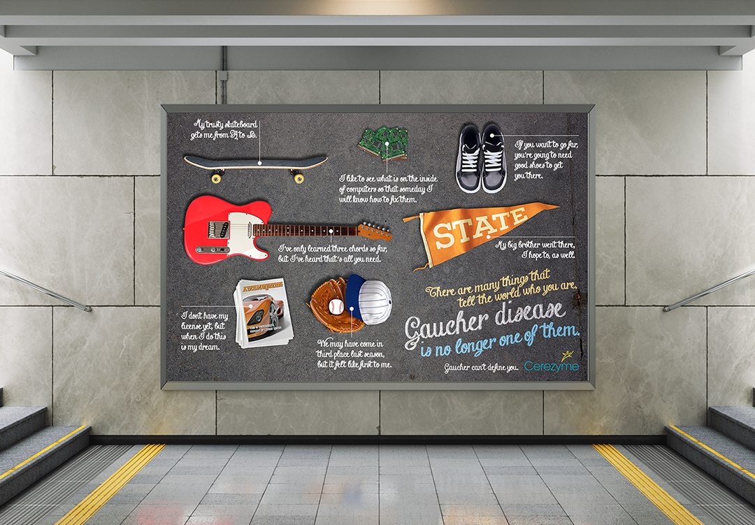
Transformative Pharma Campaigns
Crafting campaigns that empower patients, educate providers, and position breakthrough therapies with clarity and impact.
-
![]()
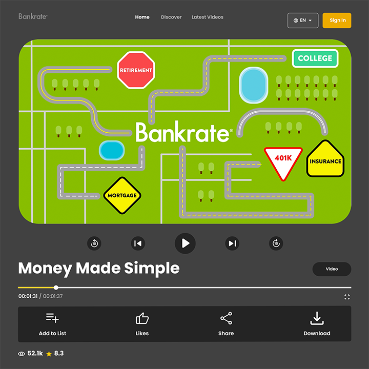
Bankrate "Money Made Simple" Information Video
Translating personal finance complexity into clear, accessible motion design that empowers decision-making.


the Path
Tracing the steps of a creative path built across industries, teams, and stories.
Career Highlights
Forescout Technologies Directed 750+ projects across digital, print, and events, including 50+ global conference exhibits supporting a $100M pipeline. Oracle Designed campaigns contributing to a $600M global pipeline, aligning digital marketing with brand storytelling at scale. SMANYC Delivered branding and campaign work for clients including Kyocera, blending design with marketing strategy. Big Arrow Group Developed creative campaigns for healthcare clients such as Greenwich Hospital, Genzyme, and Procysbi. Geoff Bock Design and Motion Independent studio producing motion graphics, digital design, and branding for diverse clients and industries.
the Story (so far…)
A creative journey shaped by industries, ideas, and the pursuit of meaningful design.
I am an emerging GIS professional with a strong background in visual storytelling and more than 12 years of experience translating complex ideas into clear, decision-ready graphics and digital experiences as a designer and art director. For over a decade I've translated complex ideas into clear, compelling visuals for brands like PwC, Intel, and JP Morgan Chase, and led brand design at Forescout Technologies, a global cybersecurity company. I am now applying that foundation to GIS, with hands-on training in ArcGIS Pro, ArcGIS Online, spatial analysis, cartography, SQL, and Python. I'm currently completing the Enterprise GIS Professional Certificate through Bootcamp GIS, building real analytical projects from the ground up.
My work is focused on turning spatial data into maps and workflows that help teams understand patterns, compare scenarios, and act with confidence. Recently, I built a four-scenario residential infill capacity model for Prince William County, Virginia, using attribute joins, ModelBuilder automation, and Python-based field calculations, then published the results as an interactive ArcGIS Online web map. I also explored NDVI analysis and urban greenspace stress in Portland, using NDVI and PRISM data to study how environmental conditions can shape urban vegetation health. These projects strengthened my ability to manage geospatial workflows from analysis through presentation, while making technical findings accessible to planners and other non-technical stakeholders.
I bring a detail-oriented approach, a collaborative mindset, and a strong eye for cartographic clarity. I am especially interested in roles where GIS analysis, data management, and map production support planning, operations, environmental, or infrastructure decisions. I am comfortable working across spatial datasets, building repeatable workflows, and refining outputs so they are both accurate and easy to use. My technical toolkit includes ArcGIS Pro, ArcGIS Online, ModelBuilder, Python, SQL, spatial analysis, geospatial data management, and cartographic design. I enjoy using these skills to create maps and analyses that are practical, visually clear, and grounded in real-world needs.
If you are looking for someone who can combine technical GIS skills with clear communication and polished map design, I would welcome the opportunity to connect.